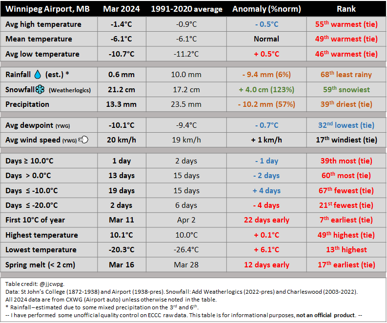
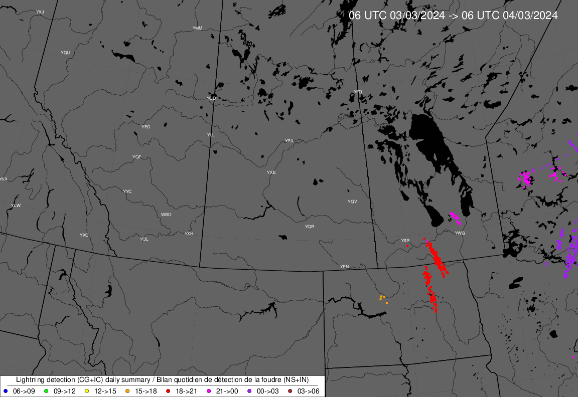
- Colorado Low of March 3rd-4th brought several hours of intermittent freezing rain in the Winnipeg area. Ice accretion combined with strong winds produced several power outages across southern Manitoba. Power flashes were witnessed in Winnipeg during the night. The system also brought thunderstorms south of Portage la Prairie and north of Winnipeg. Loud thunder, frequent lightning and small hail or ice pellets were witnessed. The storms primarily had snow, freezing rain or ice pellets associated with them, rather than rain. Southwestern Manitoba had a major snowstorm with the system with 25 to 35 cm. Brandon received around 30 cm. The system brought abnormally warm weather south of the border with Minneapolis reaching 22°C, the earliest date on record to reach at least 21°C.
March 10 - 10.7°C in McCreary - ECCC station
March 11 - 17.8°C in Hadashville - Mb Fire station
March 12 - 13.6°C at Cache Lake (in the Duck Moutains) - Mb Fire station
March 13 - 11.4°C at Rosenburg Forest (eastern Manitoba) - Mb Fire station
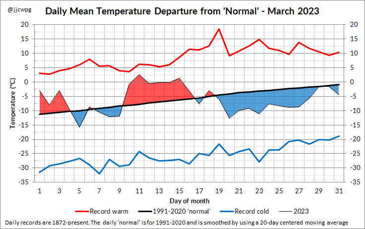
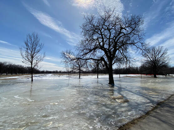
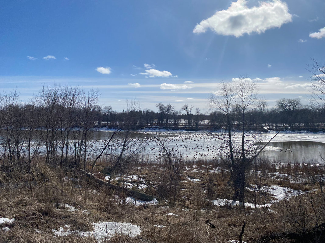
- The general snow cover melted away in Winnipeg by mid month, around the 15-16th. However, cold weather the remainder of the month prevented a total melt of the snow cover with at least a trace remaining the rest of the month. Large puddles and pools of water had frozen over on fields and streets, making for slippery conditions the entire second half of the month.
 RSS Feed
