Top 30 Driest APRILS - WINNIPEG (since 1872)
|
Rank |
Rainfall
(mm) |
Snowfall
(cm) |
Precipitation
(mm) |
Rank |
|||
|
1 |
0.0 |
1880 |
0.0 |
1900 |
T (2) |
1980 |
1 |
|
2 |
0.0 |
1907 |
0.0 |
1906 |
0.8 |
1987 |
2 |
|
3 |
T (1) |
2018 |
0.0 |
1925 |
0.8 |
1988 |
3 |
|
4 |
T (2) |
1980 |
0.0 |
1944 |
1.7 |
2018 |
4 |
|
5 |
0.4 |
1988 |
0.0 |
1980 |
2.0 |
1949 |
5 |
|
6 |
0.5 |
1926 |
0.0 |
1998 |
3.8 |
1873 |
6 |
|
7 |
0.8 |
1987 |
T (1) |
1898 |
4.1 |
1926 |
7 |
|
8 |
1.9 |
1995 |
T (1) |
1915 |
4.4 |
2000 |
8 |
|
9 |
2.0 |
1949 |
T (1) |
1955 |
5.2 |
1977 |
9 |
|
10 |
2.3 |
1936 |
T (1) |
1987 |
5.6 |
1917 |
10 |
|
11 |
2.5 |
1873 |
T (1) |
1993 |
6.3 |
1983 |
11 |
|
12 |
2.5 |
1950 |
T (1) |
2006 |
6.4 |
1905 |
12 |
|
13 |
2.5 |
1983 |
T (1) |
2012 |
6.4 |
1956 |
13 |
|
14 |
3.2 |
2000 |
T (2) |
1876 |
7.1 |
1943 |
14 |
|
15 |
3.3 |
1905 |
T (2) |
1885 E |
7.6 |
1900 |
15 |
|
16 |
3.3 |
1909 |
T (2) |
1886
O |
7.6 |
1916 |
16 |
|
17 |
3.6 |
1882 |
T (2) |
1895 |
7.6 |
1920 |
17 |
|
18 |
3.6 |
1917 |
T (2) |
1969 |
7.6 |
1952 |
18 |
|
19 |
4.1 |
1923 |
T (3) |
1891 |
8.1 |
1944 |
19 |
|
20 |
4.1 |
1956 |
T (7) |
1943 |
8.6 |
1931 |
20 |
|
21 |
4.3 |
1875 E |
T (9) |
1949 |
9.0 |
1995 |
21 |
|
22 |
4.4 |
1982 |
0.4 |
1988 |
9.1 |
1882 |
22 |
|
23 |
4.6 |
1874 |
0.5 |
1916 |
9.9 |
1876 E |
23 |
|
24 |
4.7 |
1977 |
0.5 |
1930 |
10.4 |
1913 |
24 |
|
25 |
5.1 |
1931 |
0.8 |
1946 |
11.2 |
1936 |
25 |
|
26 |
5.1 |
1933 |
0.8 |
1963 |
11.7 |
1904 |
26 |
|
27 |
6.4 |
1887 |
0.8 |
2004 |
12.7 |
1981 |
27 |
|
28 |
6.4 |
1952 |
1.0 |
1881 |
13.0 |
1972 |
28 |
|
29 |
6.6 |
1904 |
1.0 |
1903 |
13.2 |
1922 |
29 |
|
30 |
6.6 |
1920 |
1.0 |
1920 |
13.3 |
1982 |
30 |
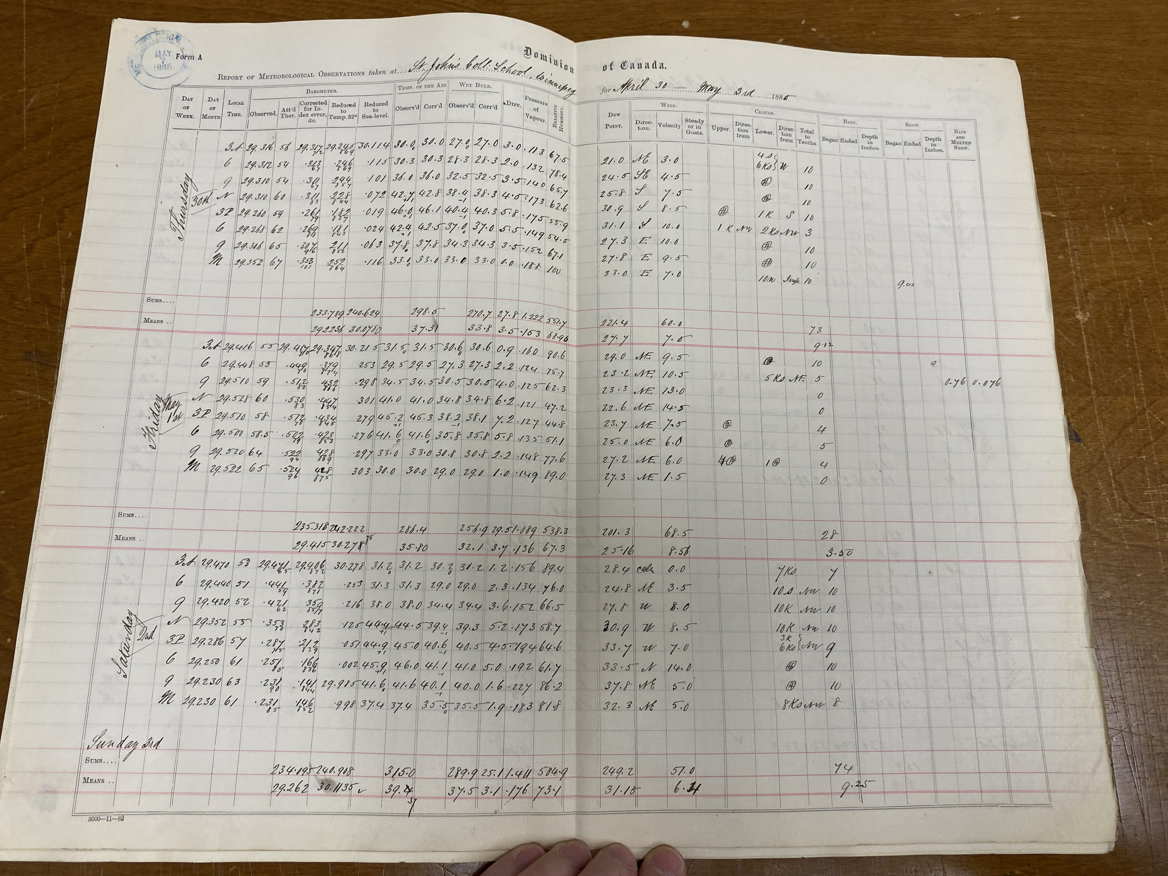
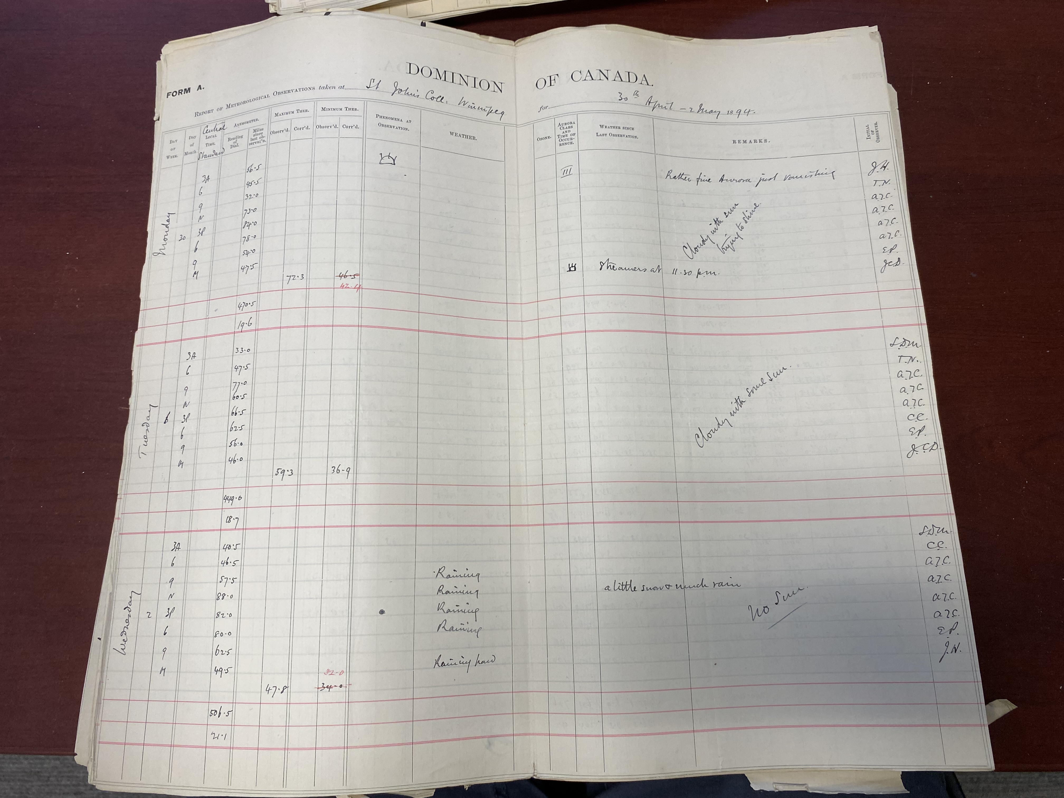
1885 - Snowfall changed from 0.0 cm to trace (x2): Snow that was entered on May 1st in the ECCC Archives actually began around 9pm on April 30th, as evidenced in the observer notes from St John's College and St Boniface College. At St Boniface College, 0.5 cm of snow was also reported on April 13th. St John's College reported nothing that day so I am assuming a trace that day (possibly omitted by observer - but at the very least, some snow fell in parts of the city). These observations were retrieved at the Library and Archives of Canada in Winnipeg.
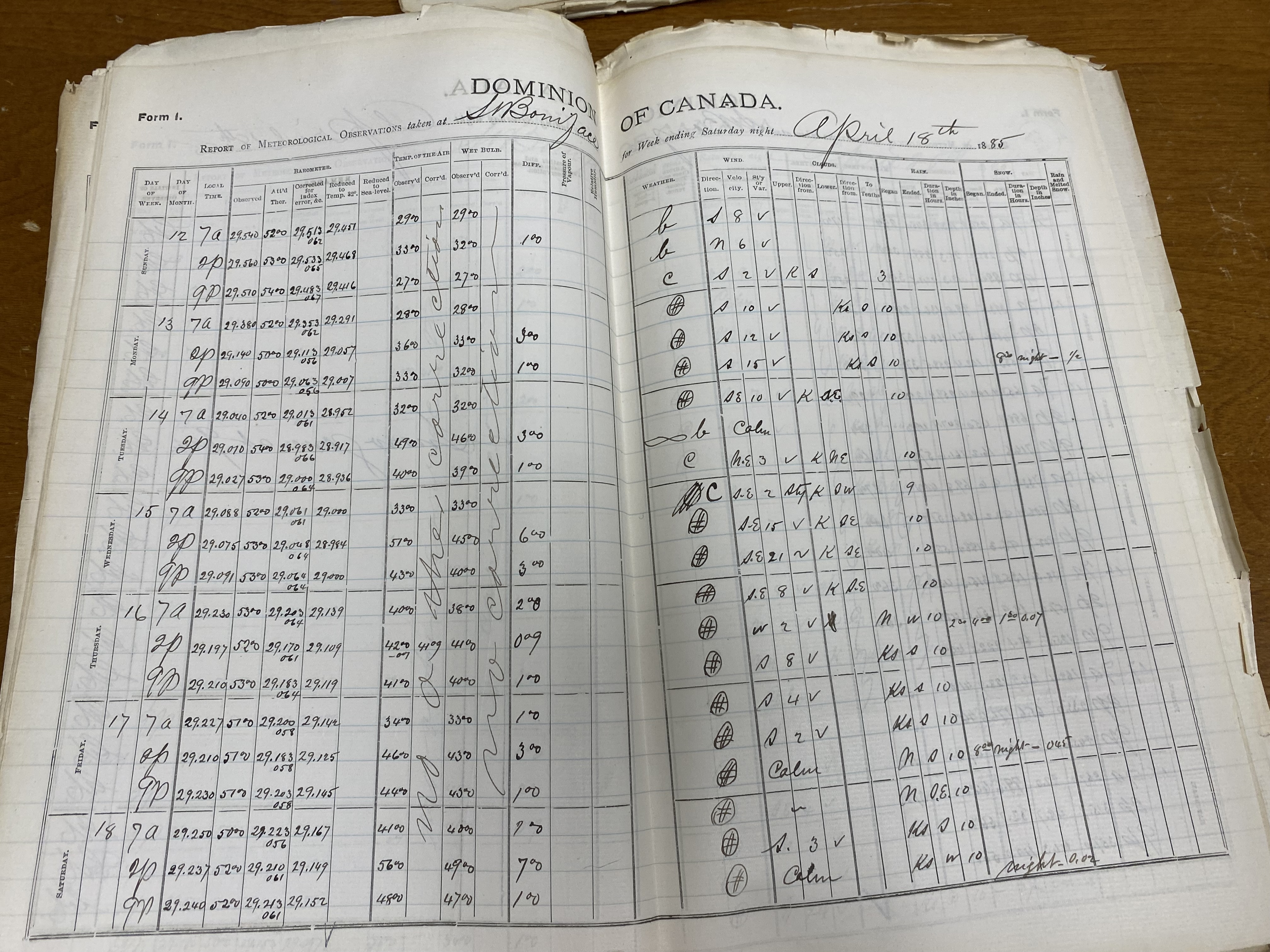
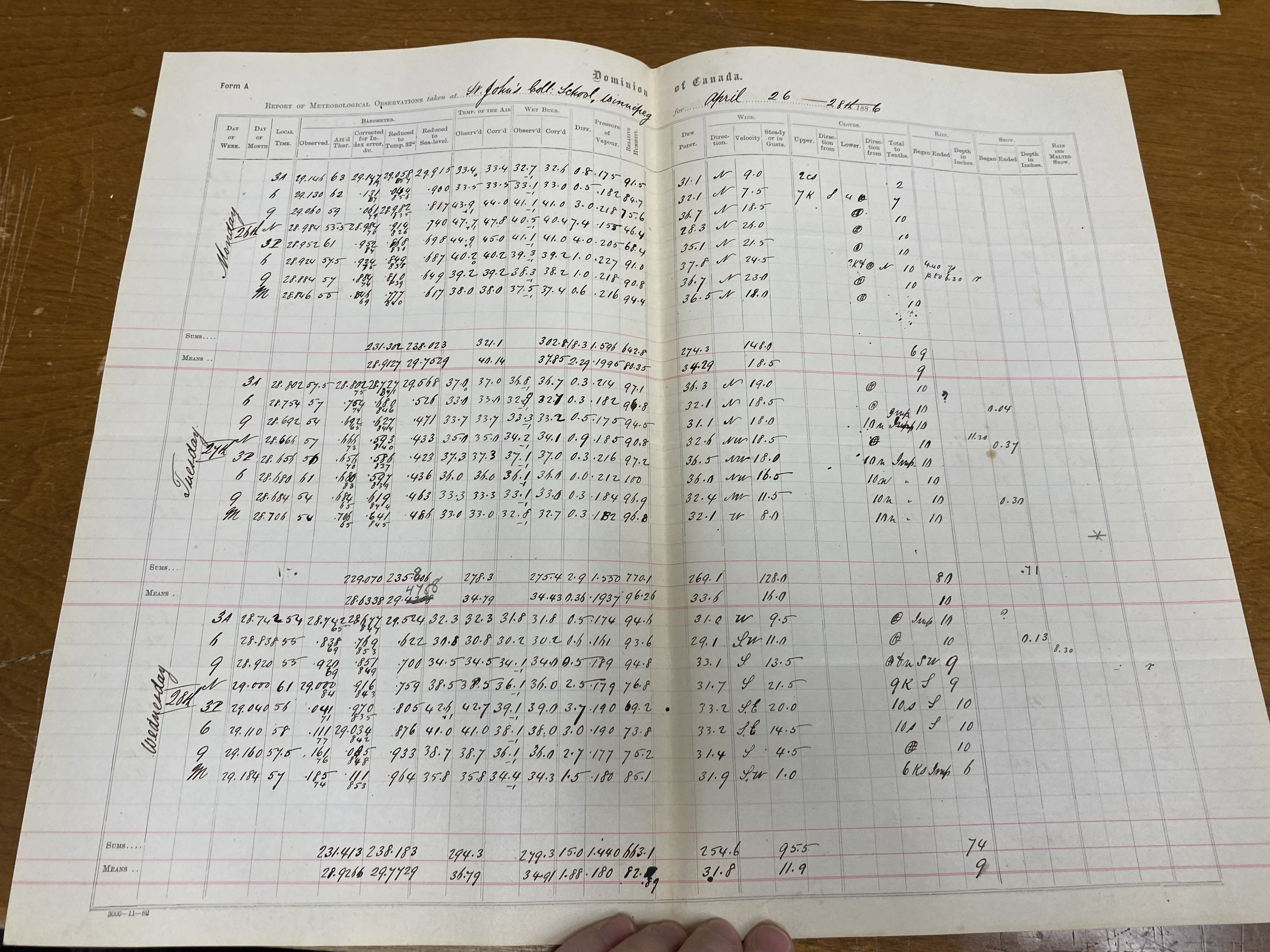
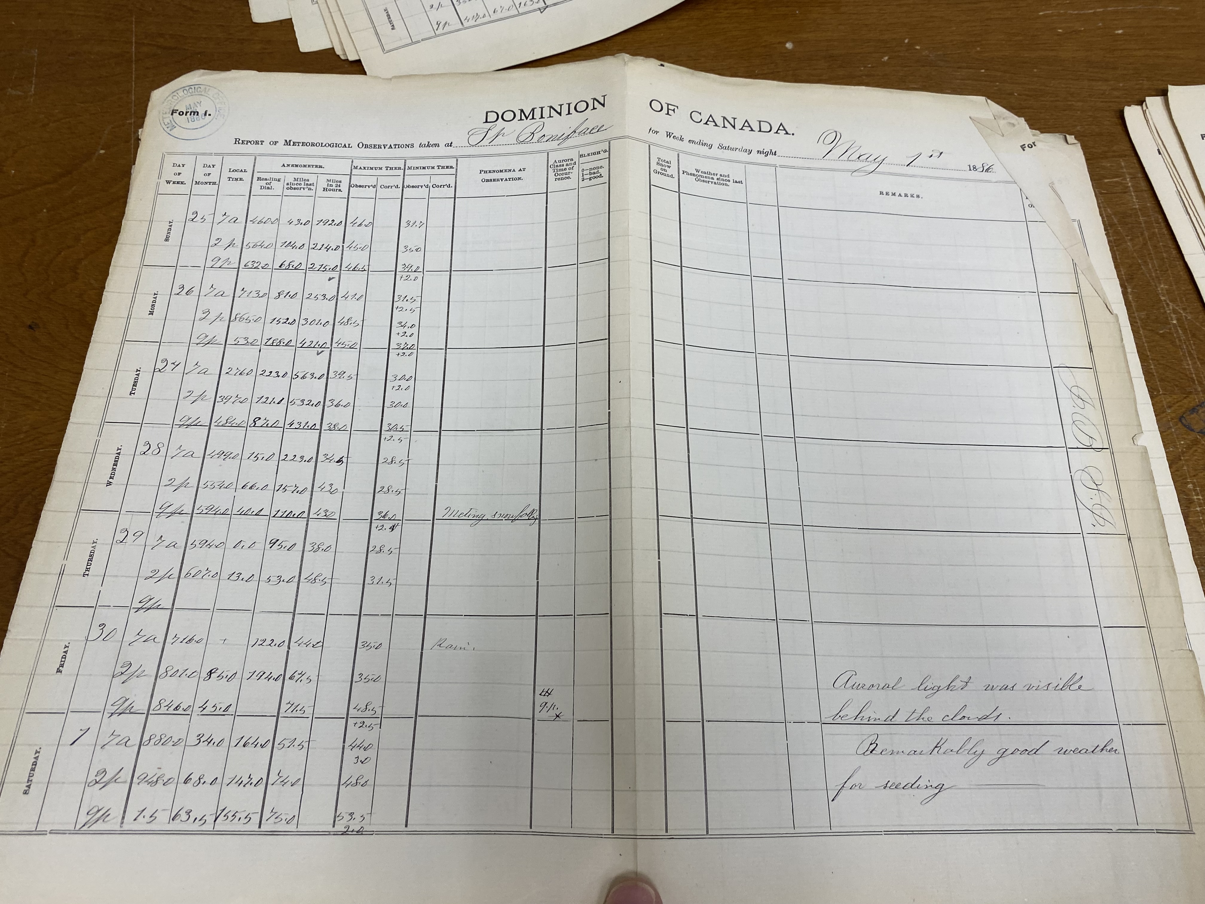
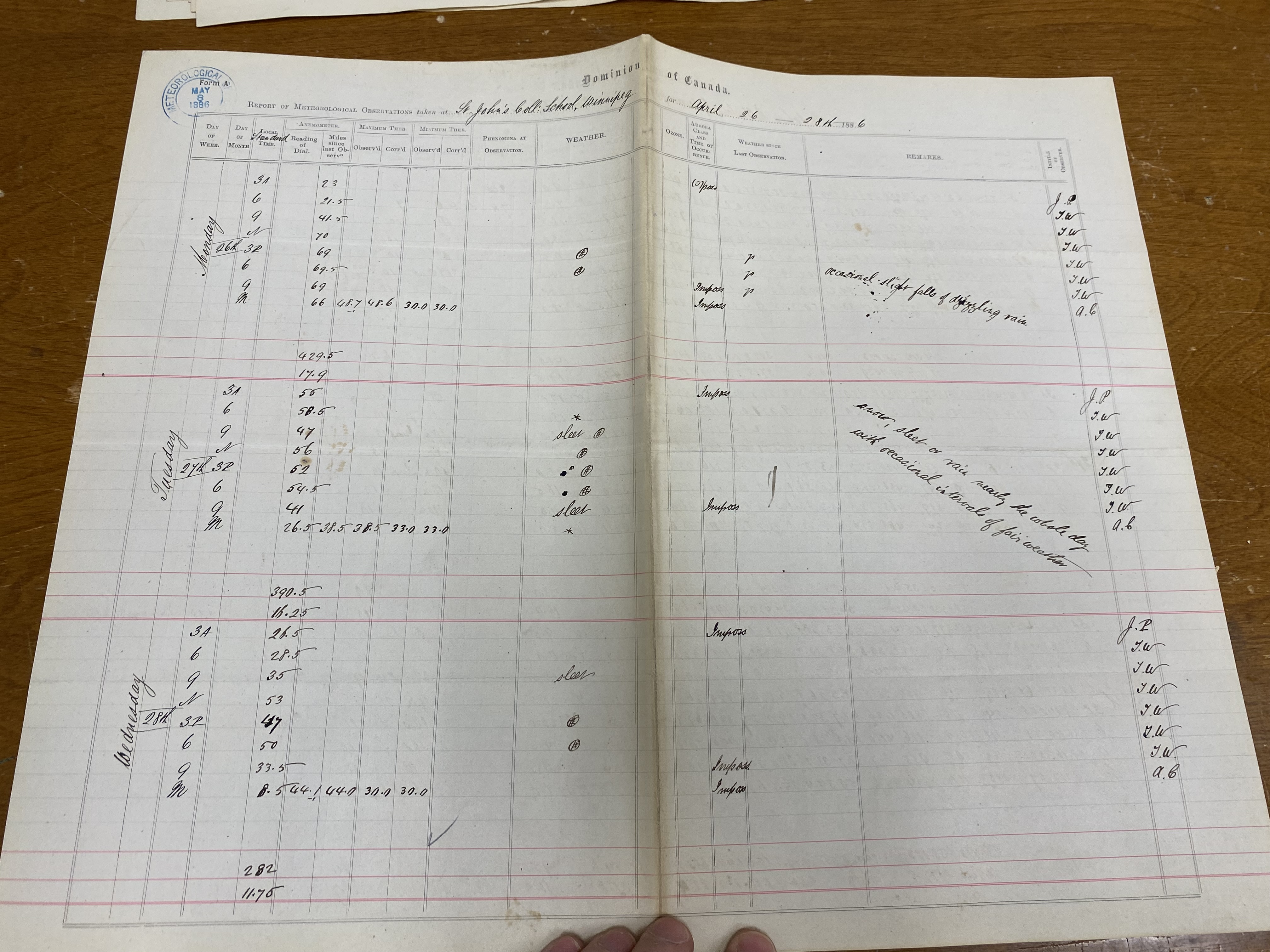
1886 - Snowfall changed from 0.0 cm to trace (x2): Both St John's College and St Boniface College reported snow (and sleet (ice pellets)) intermittently on the 27th and 28th (and possibly early on the 29th but this is less certain). I am assuming trace based on no accumulations reported. These observations were retrieved at the Library and Archives of Canada in Winnipeg.
Graphs:
Rainfall:


